Geophysical
GEOPHYSICAL FOR EXPLORATION
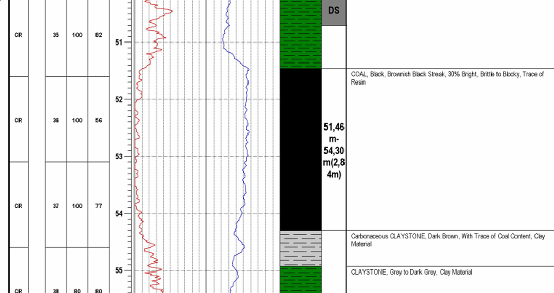
Borehole Logging:
- Borehole logging is conducted to gather detailed information about the geological and geotechnical properties of the subsurface.
- The primary objectives include assessing rock and soil types, identifying geological structures, determining water content, and measuring physical properties such as porosity and permeability.
Gamma Ray Logging:
- Measures natural gamma radiation emitted by the surrounding rock formations.
- Useful for identifying lithology, distinguishing between different rock types, and detecting the presence of radioactive minerals.
Electrical Resistivity Logging:
- Measures the electrical resistivity of the surrounding rocks.
- Measures the electrical resistivity of the surrounding in disposal to identify soft materal zone.
- Provides insights into the composition and moisture content of the subsurface, aiding in hydrogeological and geotechnical analyses.
Acoustic Logging:
- Utilizes sound waves to measure the acoustic properties of rocks.
- Assesses rock density, porosity, and the presence of fractures, providing valuable information for geotechnical stability assessments.
Caliper Logging:
- Measures the diameter of the borehole to identify variations in hole size.
- Essential for evaluating borehole stability and assessing the quality of the borehole wall.
Neutron Porosity Logging:
- Measures the neutron absorption properties of the subsurface.
- Provides information about porosity and moisture content, aiding in groundwater studies and reservoir characterization.
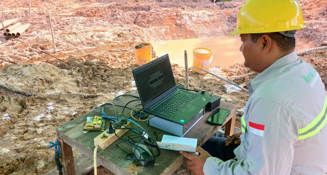
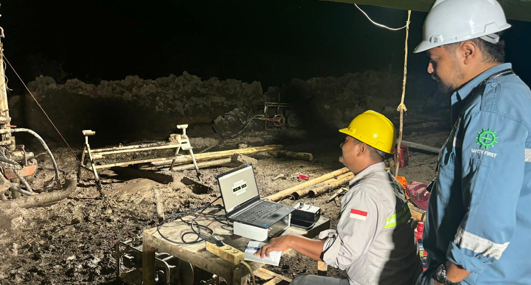
Downhole Tools and Instruments:
Logging Tools:
- Logging tools are lowered into the borehole to collect data at various depths.
- Tools may include gamma ray probes, resistivity sondes, acoustic sensors, and other specialized instruments.
Wireline Logging:
- Wireline logging involves the deployment of logging tools on a cable (wireline) that can be raised and lowered through the borehole.
- Allows for efficient data collection at multiple depths without the need to pull the entire tool string out of the borehole.
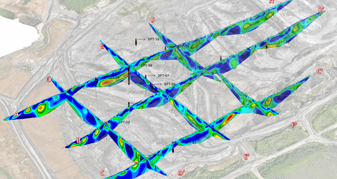
GEOPHYSICAL FOR GEOTECH SUPPORT
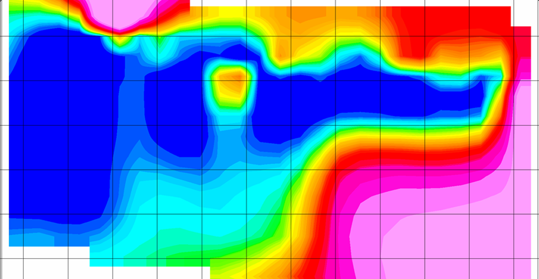
Geo-Electricial for Disposal Area:
- Measured the electrical resistivity of disposal areas, focuses to identify soft materal zone and displacement potensial.
Geo-Electricial for Drain Hole:
- Measured the electrical resistivity of pit area, focuses to indentify low resistivity. Low resistivity is akuifer target for drain hole.